NextPrevious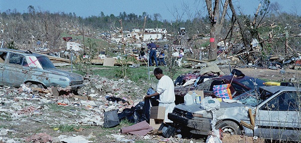 After a disaster, when the “normal” means to describe locations, such as street signs, are gone, the U.S. National Grid provide a standardized grid reference system that is seamless across jurisdictional boundaries and allows for pinpointing exact locations.
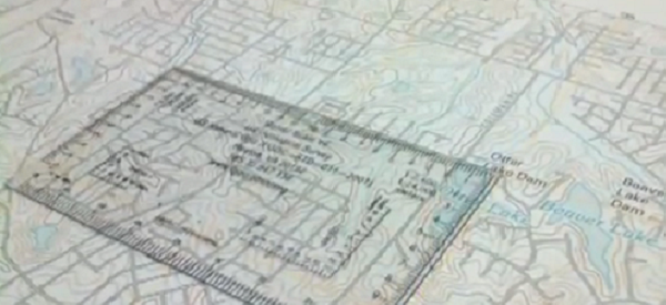 Use USNG hard-copy maps or online maps that enable coordinates to be described exactly. Romer readers can be used to find the exact USNG coordinates to describe any place in a uniform, standardized manner.
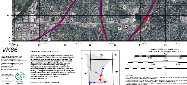 Hard-copy maps of an area are an essential part of emergency management preparation.Several states and regions provide pre-made maps and atlases that include landmarks such as schools, hospitals and police stations on standardized USNG products.See if your area is covered in Map Books by State
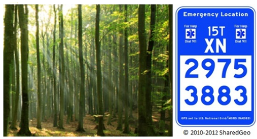 You are walking along a forest trail and come across a seriously injured hiker. U.S. National Grid Emergency Location Markers (ELMs) could help deliver a speedy response!
Since USNG is standardized, it can be understood and used as a common geographic framework for response. Learn more about how it works in USNG Overview articles.
Learn more about the USGS U.S. Topo products that include USNG.
Learn how to buy Romer Readers
ELMs are signs that provide the U.S. National Grid Coordinates and can be used to communicate an exact geographic location.
Learn more about Emergency Location Markers (ELMs):
– Background on ELMs
– The ELM System
– ELM Mobile App
– Print an ELM Marker
The USNG Information Center is dedicated to providing educational items and resources to support use of the U. S. National Grid.